


Before the fall temperatures and the pumpkin spice overload, a cold front will swing through, bringing scattered to numerous showers and thunderstorms on Wednesday. Rain chances will start around 10 a.m. and continue through late in the evening.
The strengthening north-northeasterly flow will intensify Wednesday night and linger through Thursday. Showers will be possible on Thursday, with locally heavy downpours possible along our coastal counties. This will bring increasing marine and coastal impacts on Thursday and Thursday night.
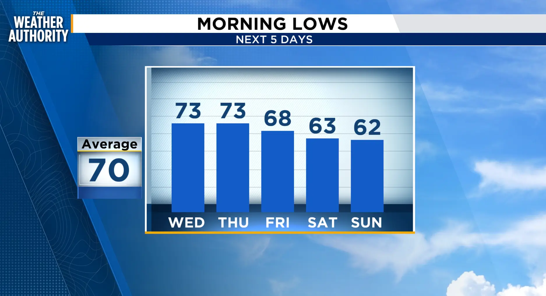
Behind the front and following the wind, cooler, calmer conditions will move in Friday, bringing pleasant conditions through the weekend.
Tonight: Scattered showers with isolated storms through 7 p.m. Partly cloudy with patchy fog late tonight and early Wednesday.
Wednesday: Increasing winds with showers and thunderstorms, mainly over northeast Florida, 50-70 percent, 20-50 percent over SE GA. Morning lows in the 70s. Afternoon highs in the 80s. Cloudy and windy overnight with showers possible.
Thursday - Friday: Windy Thursday with northeast winds 15-20 mph and stronger gusts. Coastal showers are possible. Friday will bring lighter winds and cooler temperatures.
Weekend: It looks great for your outdoor projects or activities.
Tropics: A spot to watch near Africa. Tropical Depression Fay weakens.
Sunrise: 7:16 a.m.
Sunset: 7:22 p.m.
