

The showers have ended and skies are clearing.
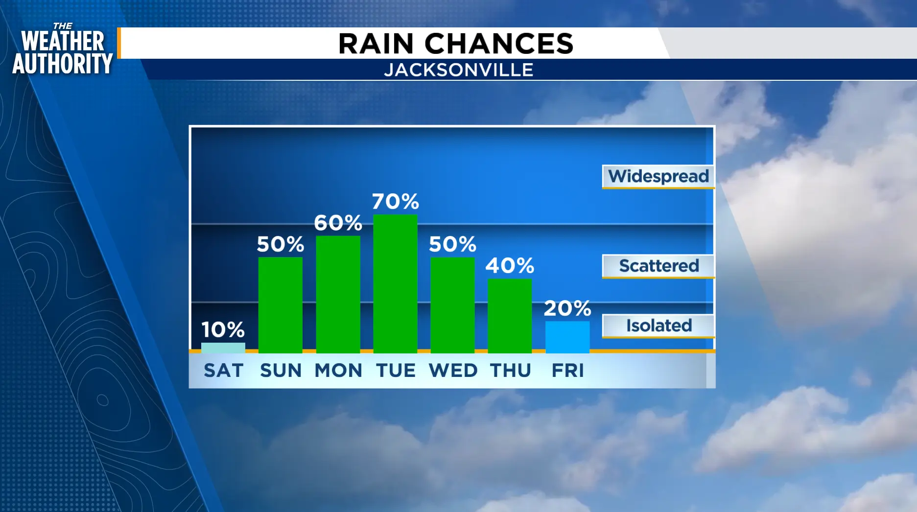
The light onshore wind will continue on Saturday with a slight chance of showers mainly south of I-10 and along our southern counties. Like today, we’ll see a mix of sun, clouds and a few showers. Temperatures will feel more like summer than fall.
Sunday will bring increasing rain chances through the afternoon and evening. Scattered showers with thunderstorms will be possible a s a large area of low pressure rotates over northeast Florida.
The pattern remains unsettled next week with scattered afternoon showers and thunderstorms, some locally heavy along the colliding sea breezes.

Tonight: Not as windy, with showers possible through around 5 p.m. Partly cloudy to mostly clear and cool overnight.
Saturday: Mostly sunny to partly cloudy then a slight chance of showers, 10-20 percent. Morning lows in the low 70s. Highs in the upper 80s to low 90s inland, 80s along the beaches. Wind: NE 5-10 mph. Mostly clear overnight.
Sunday: Increasing rain chances due to an upper level low pressure area and the persistent onshore winds. Partly cloudy then becoming cloudy with late day showers and storms possible 40-70 percent. Morning lows in the 70s. Highs in the 80s and 90s.
Tropics: A new spot to watch. Invest 99 has growing chances of development. www.news4jax.com/weather/2026/09/18/70-chance-invest-99-could-become-a-tropical-depression-today/
Sunrise: 7:13 a.m.
Sunset: 7:27 p.m.
