

JACKSONVILLE, Fla. – It certainly was hot and humid last weekend, with highs near 90 degrees, but it felt like it was above 100 degrees! This is nothing out of the ordinary, as our average high is in the upper 80s.
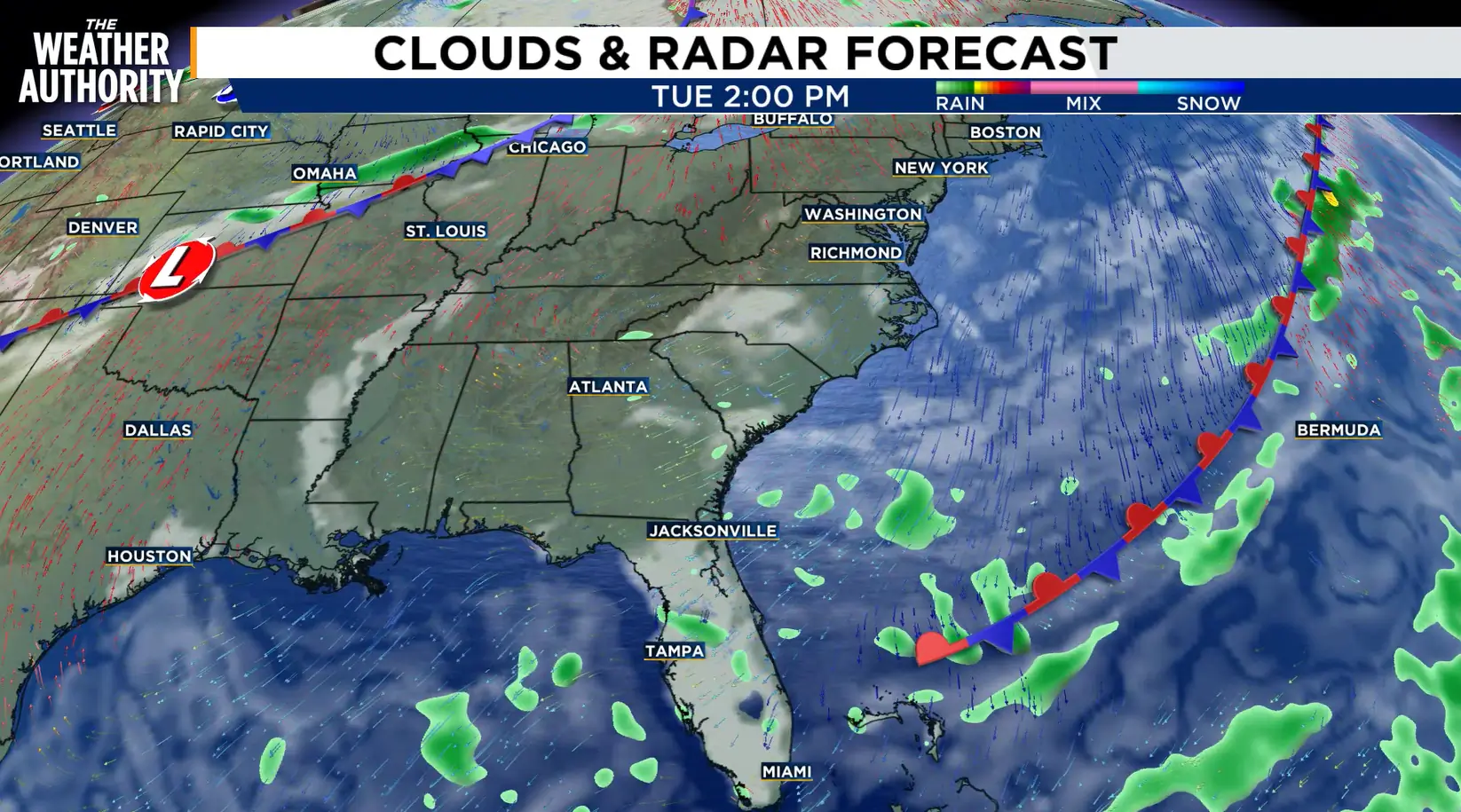
However, this time of year we start to see fronts push into Georgia and Florida.
While fronts early in the season don’t change our pattern much since they are weaker, it is a sign of what’s to come as we enter the cooler months.

The front will clear our area late Tuesday and will stall to our south on Wednesday.
Behind the front, we will see a strong northeasterly wind. This will usher in slightly drier air into the region, which means many spots will stay dry.
The drier air will also drop the humidity a bit on Wednesday.

Rain coverage will decrease to around 10% on Wednesday, which is a big change from the past few days.
We won’t notice a huge drop in humidity, but as we head into the cooler months, these fronts will bring a more drastic change in humidity.
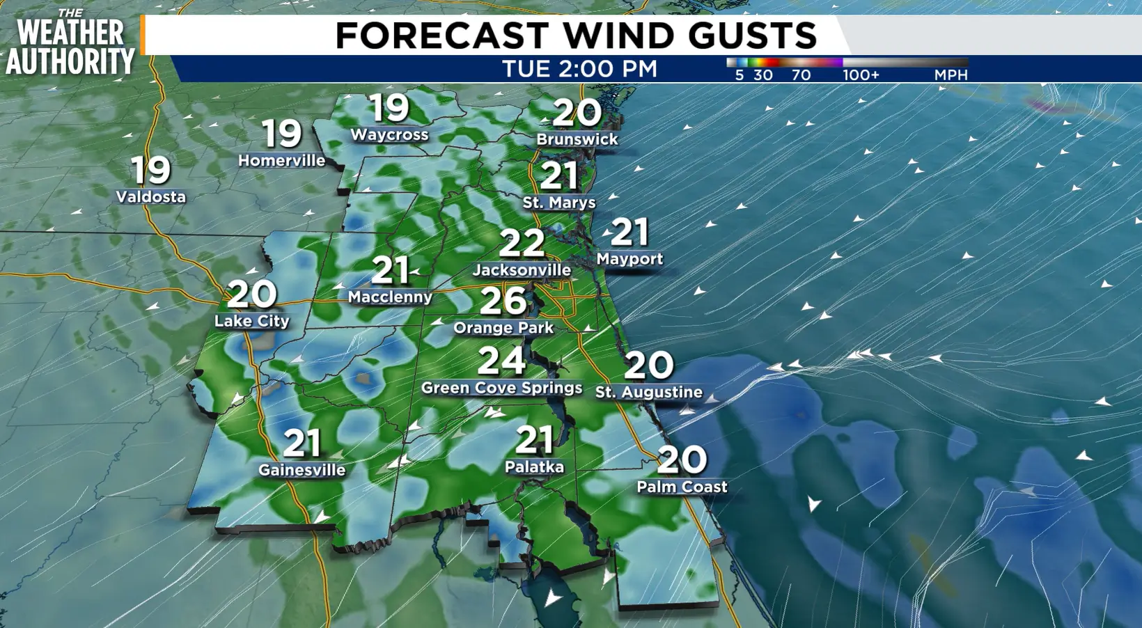
Another impact we will see from this system is stronger wind, especially along the coast. Winds could gust up to 40 mph at times on Tuesday and Wednesday.
This will bring coastal hazards to our area including a higher risk for rip currents along with rough surf. Small craft advisories will likely be needed.
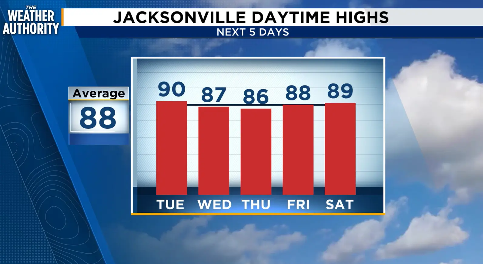
This will be short-lived, though, as a disturbance will approach our area later this week. Humidity will build as temperatures rise into the upcoming weekend. Rain and storm chances will also build.
